Section 404 Permits for Excavation Work

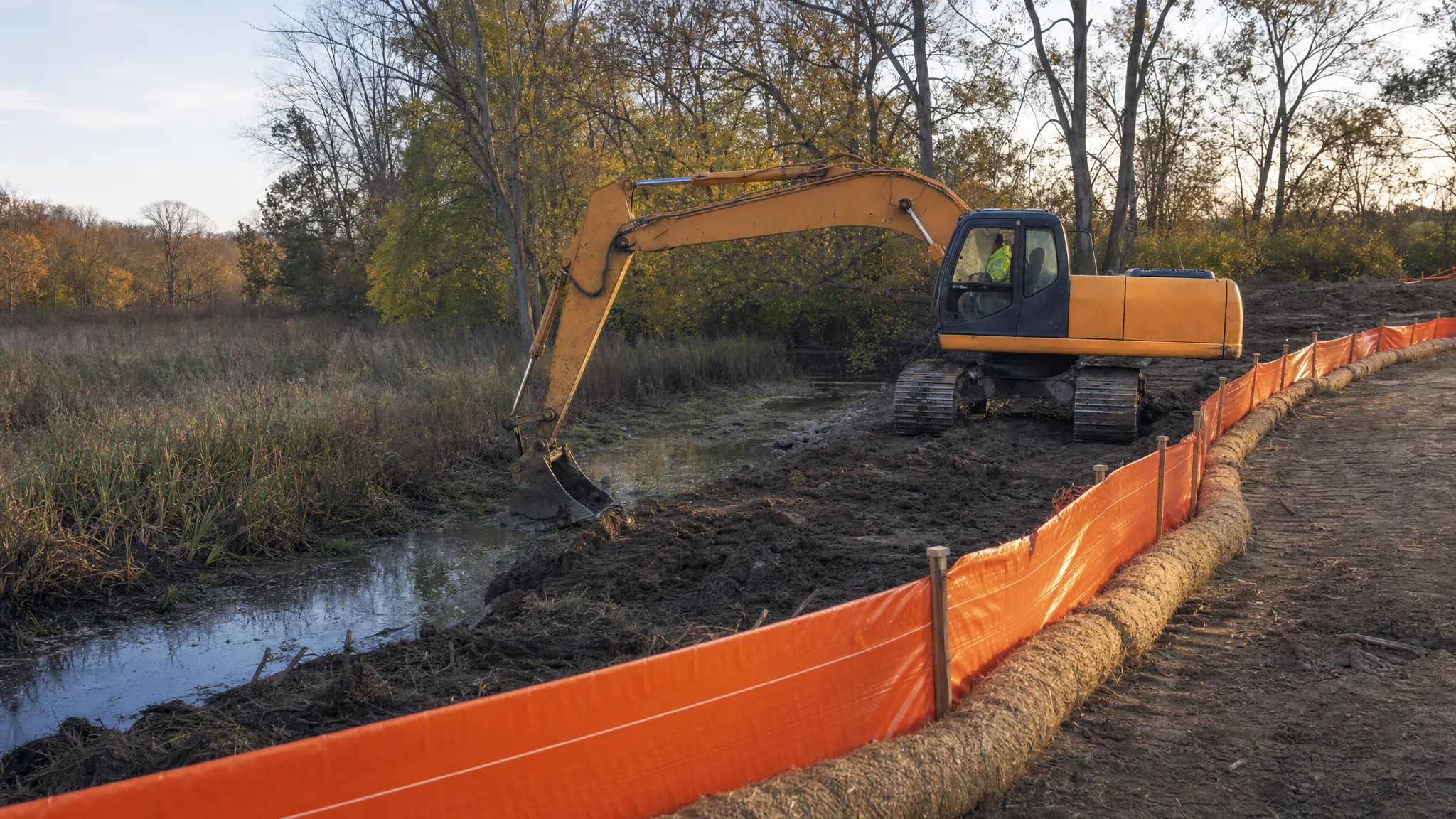
Most excavation crews plan around utilities, weather, and haul routes. The permit that stops a job cold is often the one nobody put on the schedule: a federal Clean Water Act permit for putting dirt, rock, or fill into a stream, wetland, or ditch. Section 404 of the Clean Water Act is the reason an installed driveway culvert, a farm pond, or a few hundred feet of bank riprap can turn into a months-long review — and the reason a contractor who skips it can end up restoring a site at his own expense.
This guide explains what Section 404 regulates, which earthwork activities trigger it, how the nationwide permit system works in practice, and how to plan a dig so the permit question gets answered before the machines show up.
What Section 404 Actually Regulates
Section 404 of the Clean Water Act establishes a program to regulate the discharge of dredged or fill material into waters of the United States, including wetlands. It requires a permit before that material may be discharged, unless the specific activity is exempt.
Two details matter to an excavator operator. First, the trigger is the discharge of material, not the act of digging. Excavating a pond in upland ground is not automatically a 404 activity; sidecasting the spoil into a wetland or stream is. Second, the permit is separate from every other approval on the job — a grading permit, a stormwater permit, and a 404 authorization are three different things. Nationwide permits explicitly do not remove the need for other federal, state, or local approvals.
The core policy premise is narrow. A discharge cannot be permitted if a practicable alternative exists that is less damaging to the aquatic environment, or if the nation's waters would be significantly degraded. In practice, that means an applicant has to show avoidance first, then minimization, then compensation for whatever impact remains.
What Counts as Waters of the United States
The regulated universe is defined at 33 CFR 328.3. As written, it covers traditional navigable waters and the territorial seas, interstate waters, impoundments of those waters, relatively permanent tributaries, wetlands adjacent with a continuous surface connection, and certain intrastate lakes and ponds with a continuous surface connection to those waters.
Just as important is the exclusion list, because it describes the features excavation crews work around every day:
- Ditches, including roadside ditches, excavated wholly in and draining only dry land that do not carry a relatively permanent flow of water
- Artificial lakes or ponds created by excavating or diking dry land and used exclusively for stock watering, irrigation, settling, or rice growing
- Artificial reflecting or swimming pools and small ornamental ponds
- Water-filled depressions created in dry land incidental to construction, and pits excavated in dry land for fill, sand, or gravel
- Swales and erosional features such as gullies and small washes with low volume, infrequent, or short-duration flow
Wetlands themselves are defined by conditions rather than by appearance: areas inundated or saturated by surface or groundwater at a frequency and duration sufficient to support vegetation adapted to saturated soils. That is why a soggy, brushy corner of a site with the wrong plants and the wrong soils can be jurisdictional while a similar-looking low spot is not.
The definition has been rewritten and litigated repeatedly, and the current text is not a permanent answer. Treat any borderline feature as a question for the Corps district, not for the crew.
The Earthwork Activities That Trigger a Permit
In day-to-day site work, 404 exposure usually arrives in one of a handful of forms:
- Filling a wet area to create a building pad, parking area, or driveway
- Crossing a stream with a culvert, temporary haul road, or utility line
- Bank work — riprap, gabion, or regrading that places stone or soil below the ordinary high water mark
- Pond work where excavated material is pushed into the water body or onto the wetland edge instead of being hauled out
- Ditch work that goes beyond maintenance into new construction or a change in reach or flow
Dredging an existing pond sits in the same family of questions, because the material has to go somewhere and the disposal method often decides whether a permit is needed. The same is true of land clearing that pushes debris into a drainageway instead of burning or hauling it.
Section 404(f)(1) lists activities that are exempt, including established farming, ranching, and silviculture, maintenance (not construction) of drainage ditches, construction and maintenance of irrigation ditches, farm and stock ponds, farm and forest roads built with best management practices, and maintenance of dams, dikes, and levees. The exemption has a limit: if the activity is a new use of the water and would reduce its reach or impair flow or circulation, it is not exempt. Converting a wetland to upland is generally not exempt.
Individual Permits Versus Nationwide Permits
Projects with potentially significant impacts go through an individual permit, reviewed under public interest factors and the Section 404(b)(1) guidelines, often with EPA and fish and wildlife agency comment. Most small earthwork projects instead fit a general permit — a nationwide permit, regional permit, or state-issued general permit — that authorizes a category of activity with minimal effects and little or no individual review.
Nationwide permits are not self-certifying paperwork. An activity is authorized only if the activity and the permittee meet every term and condition, including regional conditions imposed by the division engineer and any state water quality certification conditions. Some nationwide permits require a pre-construction notification to the district engineer, who then has a 45-day period to act; the permittee may not start before that period expires unless notified otherwise. Some notifications require a wetland delineation to be submitted with them.
There is also a discretion clause worth understanding: the district engineer may modify, suspend, or revoke an authorization, may add activity-specific conditions, or may decide the activity needs an individual permit after all.
The Sequence the Corps Expects You to Follow
Reviewers are looking for a documented decision trail, and it reads the same whether the project is a house, a shop, or a road:
- Avoid the aquatic resource — shift the pad, shorten the driveway, reroute the driveway culvert, or move the pond off the wet ground
- Minimize the footprint that remains — narrower crossing, shorter duration, smaller fill volume, temporary rather than permanent
- Compensate for what cannot be avoided — on-site restoration, off-site mitigation, or a payment to an in-lieu-fee or mitigation bank, as required by the authorization
Design changes made on paper are cheap. The same changes made after the fill is placed are the most expensive dirt on the site.
Wetland Delineation and the Data a Permit Needs
This is also where a project's paper trail starts to matter as much as its dirt work. A grading plan that already shows the wet area, the flow arrows, and the limits of disturbance makes the permit conversation short; a plan that ignores them turns a boundary question into a redesign. See how to read a grading plan for the sheet elements reviewers look for, and treat the local excavation and grading permits as a separate, parallel track.
A delineation is a field determination of where the regulated boundary sits, based on three parameters: hydric soils, hydrophytic vegetation, and wetland hydrology. The work follows the Corps' wetland delineation manual and the applicable regional supplement, and it is normally flagged in the field and located by GPS so the boundary can be drawn and the impact area measured.
For a stream, the corresponding line is the ordinary high water mark — the line on the bank indicated by physical characteristics such as a clear impression on the bank, shelving, changes in soil character, destruction of terrestrial vegetation, or the presence of litter and debris.
The permit package needs the impact quantified in acres of wetland and linear feet of stream, plus a plan sheet showing the limits of work relative to the flagged boundary. A jurisdictional determination from the district is the document that settles the question, and it is worth requesting early on any site with a wet corner, a ditch, or a drainageway.
What an Unauthorized Discharge Costs
An activity that requires Corps authorization and does not comply with a nationwide or individual permit is treated as unauthorized, whether it is under construction or already complete. Enforcement runs through 33 CFR 326, and it can include stop-work direction, restoration, mitigation, and civil penalties. After-the-fact authorization is possible in some cases, but it puts the contractor and owner in the position of asking permission for work already done.
The practical cost usually dwarfs the paperwork. Machines idle, imported fill has to be pulled back out, disturbed ground has to be stabilized and revegetated, the schedule slides, and the owner's financing keeps running. That is before anyone argues about who pays — which is exactly why the permit status belongs in the contract documents and in the pre-bid questions.
How to Plan Earthwork Around a Regulated Area
Once a boundary is flagged, the job becomes a boundary-management problem. The limit of disturbance should be staked or fenced so equipment cannot drift into it, and the perimeter should be protected with the appropriate stormwater controls before any clearing begins.
- Keep the flagged line visible — flagged wire, high-visibility fencing, and a posted plan sheet in the machine
- Install silt fence and, where the drainage area demands it, sediment traps along the boundary before the first cut
- Never push spoil, slash, or demolition debris into a stream, wetland, or ditch
- Use a temporary crossing designed for the load and remove it when the authorization requires it
- Keep refueling, concrete washout, and stockpiles outside the boundary and away from flow paths
- Respect seasonal or timing restrictions written into the permit — they are usually there for a reason
- Photograph the pre-existing condition of the boundary before mobilizing
Note the separation of programs: a stormwater pollution prevention plan controls muddy runoff from the site, while Section 404 controls what material gets placed in the water. Complying with one does not satisfy the other.
Field Rules That Keep a Crew Out of Trouble
The field failures are consistent. Someone decides a small wet spot is "just a low area" and fills it. A crossing is installed without notification. A ditch is "cleaned out" and its geometry changes. A pond is enlarged and the spoil ends up on the wet side of the embankment.
The habits that prevent those failures are simple: the flagged boundary is a hard line, not a suggestion; any change to the limits of work goes back through the permit, not through the operator; the authorization, plan sheet, and any conditions stay on site; and any deviation gets reported the same day, while the fix is still cheap.
Pre-Construction Checklist
- Screen the site for wetlands, streams, ditches, and drainageways before design is final
- Request a jurisdictional determination on anything borderline
- Design to avoid the resource, then minimize, then plan compensation
- Confirm which authorization applies — individual, nationwide, regional, or state general permit
- Check for a pre-construction notification requirement and the 45-day review window
- Confirm state water quality certification and any regional conditions
- Check utility locates separately — a 404 review does not locate a gas main
- Quantify impacts in acres and linear feet and match them to the plan sheets
- Stake or fence the limit of disturbance and install stormwater controls before clearing
- Brief the operator, the foreman, and the trucking crew on the boundary and the no-sidecast rule
- Keep the authorization, conditions, and as-built documentation in the job file
None of this replaces the district's own guidance, and none of it is legal advice. It is the difference between a project that gets reviewed on paper and one that gets reviewed in the mud.